Ecosystems
Ecosystems aims to facilitate the research, discovery, and exploitation of environmental data.
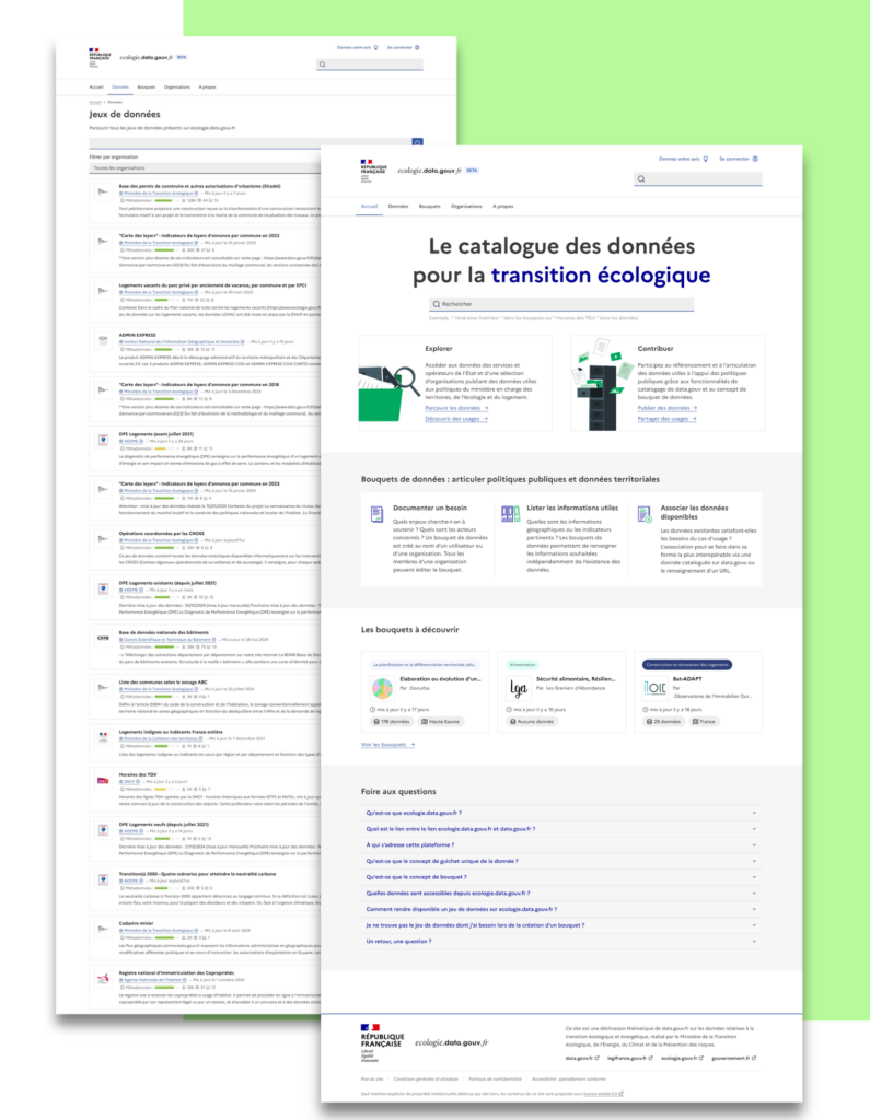
The project led to the launch of the ecology.data.gouv platform which collects all environmental data available to the State and its operators.
Providing centralized access to environmental data
Previously scattered across different catalogs, nearly 30,000 datasets covering various themes, from reference organizations such as IGN, Météo France, Ademe, Cerema, OFB, BRGM as well as decentralized services of the State, are gathered on this platform.
This centralization of data is the result of close collaboration with territorial data platforms and is based on a digital common developed jointly with the already highly frequented national platform data.gouv.fr.
This work is part of the key actions of the ministerial roadmap for data, algorithms, and source codes of ecological transition and territories.
The integration of data from regional directorates will continue in early 2025.
The platform was launched by Agnès Pannier-Runnacher, Minister of Ecological Transition, Energy, Climate, and Risk Prevention during the 2024 Mayors and Local Authorities Expo.
A new cataloguing of data by use cases: territorial data bouquets
Ecologie.data.gouv.fr offers an innovative feature for cataloguing data by usage, called “data bouquets”. These bouquets facilitate the linking of territorial data to the specific needs of a public policy. The aim is to make data use more efficient according to local issues and to accelerate research on it.
The territorial data bouquets have a dual objective of promoting and facilitating the deployment of digital services based on territorial data. They particularly target GIS or data services, data innovation laboratories, State startups, as well as study offices and any other structures initiating such services.
These data bouquets will highlight local initiatives by giving them national visibility so they can be replicated in other territories.
For example, in line with the climate change adaptation policy of the Lyon Metropolis, a bouquet was created around its “plantability map”, a resource that helps guide urban greening strategies. This initiative inspired the Bordeaux Metropolis, which has implemented a similar approach for its own needs.
These advancements were made possible by choosing an architecture based on the data.gouv platform and a fruitful collaboration with its team. This collaboration leads to a digital common known as “view on data.gouv” that already benefits Météo France and attracts the interest of other administrations. It is a “white label” layer of data.gouv allowing the creation of thematic verticals on the data of data.gouv.
The code is open on GitHub :opendatateam/udata-front-kit.